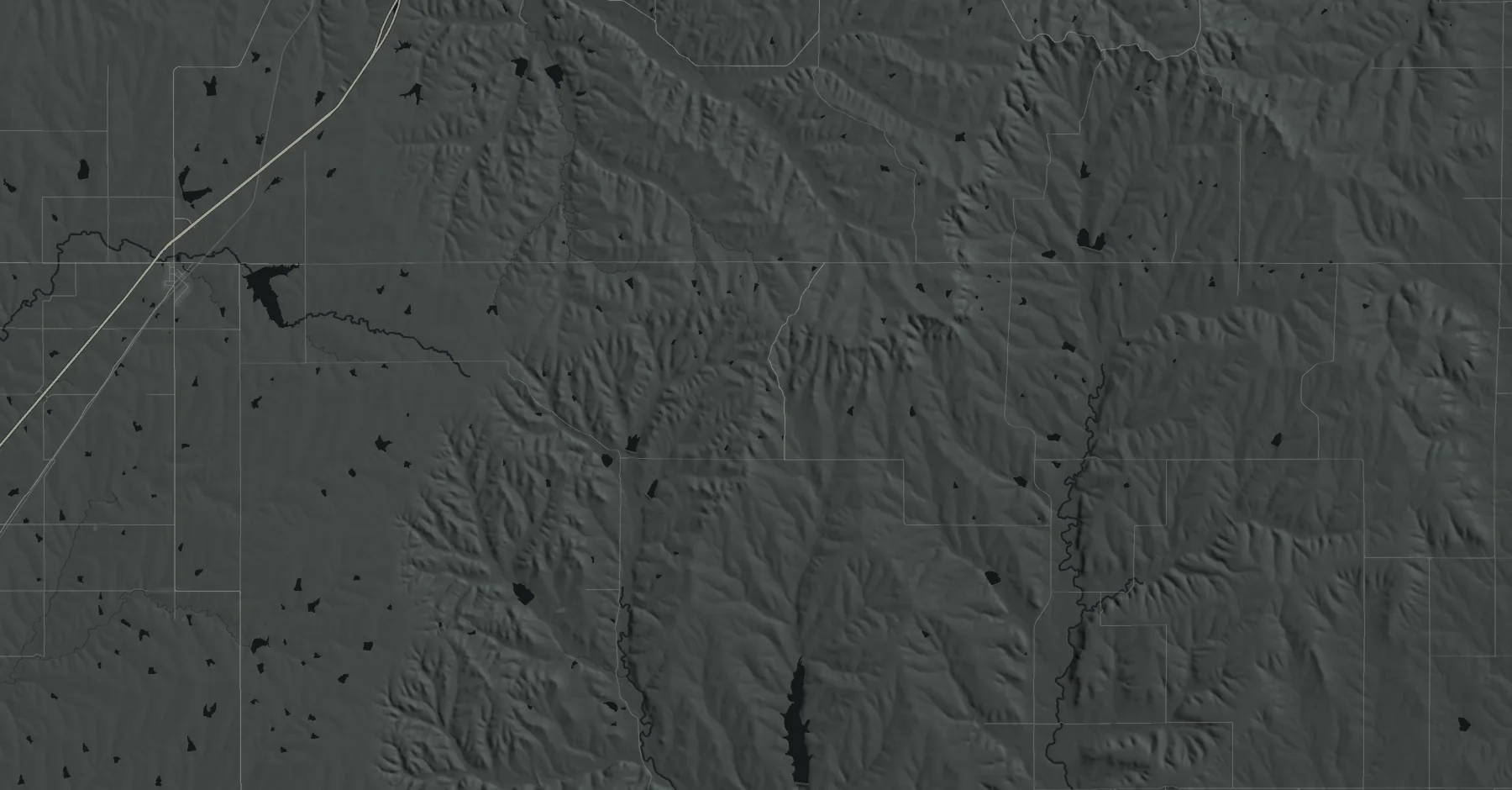
An out-and-back on gravel county roads through open-range Flint Hills pasture east of Cassoday, under a mile of it paved and cattle loose on the road.

Gravel roads. The outbound leg sits between 1,218 and 1,563 ft. Open-range tallgrass prairie; the October page says there are very few places on the road with shelter from the elements.
Teterville Road decides it. Leave mile 25 by 1:00 PM, which is 16:48 a mile from the start. No other cutoff asks for a faster pace.
0:04 in hand at Teterville Road. The tightest point on this plan.
75° or warmer in 4 of 11 years. Gusts of 35 mph or more in 2 of 11. Felt below freezing in 1 of 11.
The typical year: 69° at the warmest hour, 50° at the coldest, feeling like 48°.
75° or warmer in 4 of 11 years. Gusts of 35 mph or more in 2 of 11. Felt below freezing in 1 of 11.
The typical year: 69° at the warmest hour, 50° at the coldest, feeling like 48°.
Every item answers something on this page. None are required by the race. The rest follow from the trail, the weather and a very long day.
The cup policy is not published. Bring your own and it doesn't matter.
Gravel county roads for 50 miles with under a mile of pavement and no trail described. Cushion for hard-packed road matters more than lugs.
The whole course is gravel road; the fines work into a shoe over a long day. Low debris gaiters, not the alpine kind.
Stations on the October table are 3.6 to 4.6 miles apart on this road, water-only every other stop, but the spring page publishes no miles of its own. Carry for the 4.6-mile first and last legs and a mile of doubt, on open prairie with May 1 highs to 80°.
On May 1 the day's low falls at the 6 AM start every year; the coldest start hour has ranged from 40° (2017) to 64° (2018) and felt like 28° to 60°. A layer you can shed at Battle Creek.
Open range with very little to break the wind, and an out-and-back faces it both ways. Gusts of 35 mph or more on May 1 in two of the last eleven years (45 mph in 2018, 44 in 2017); that is the date, not past race days.
Rain of 0.1 in or more on May 1 in one of the last eleven years (0.28 in, 2019). The October page says lightning is the greatest danger on this road and you are often the highest object; a shell is for the day it happens.
Open prairie with very little shelter from 6 AM to as late as 9 PM; median May 1 high 69°, highs 56° to 80° over eleven years.
No lights rule is published. The 15-hour cutoff is 9 PM, after sunset in May, and the last 2026 50-mile finisher came in at 8:17 PM on unlit gravel roads.
3 manned stations take bags for the 50 mi; the 50-mile text counts five visits to them. Mark each with your name and bib and leave it at the start/finish staging area by 5:30 AM.
The organizer publishes nothing about what the manned stations stock, and stashing supplies on the course is against the rules. What you need rides with you, in a drop bag or with crew at Lapland or Teterville.
Every item answers something on this page. None are required by the race. The rest follow from the trail, the weather and a very long day.
The cup policy is not published. Bring your own and it doesn't matter.
Gravel county roads for 50 miles with under a mile of pavement and no trail described. Cushion for hard-packed road matters more than lugs.
The whole course is gravel road; the fines work into a shoe over a long day. Low debris gaiters, not the alpine kind.
Stations on the October table are 3.6 to 4.6 miles apart on this road, water-only every other stop, but the spring page publishes no miles of its own. Carry for the 4.6-mile first and last legs and a mile of doubt, on open prairie with May 1 highs to 80°.
On May 1 the day's low falls at the 6 AM start every year; the coldest start hour has ranged from 40° (2017) to 64° (2018) and felt like 28° to 60°. A layer you can shed at Battle Creek.
Open range with very little to break the wind, and an out-and-back faces it both ways. Gusts of 35 mph or more on May 1 in two of the last eleven years (45 mph in 2018, 44 in 2017); that is the date, not past race days.
Rain of 0.1 in or more on May 1 in one of the last eleven years (0.28 in, 2019). The October page says lightning is the greatest danger on this road and you are often the highest object; a shell is for the day it happens.
Open prairie with very little shelter from 6 AM to as late as 9 PM; median May 1 high 69°, highs 56° to 80° over eleven years.
No lights rule is published. The 15-hour cutoff is 9 PM, after sunset in May, and the last 2026 50-mile finisher came in at 8:17 PM on unlit gravel roads.
3 manned stations take bags for the 50 mi; the 50-mile text counts five visits to them. Mark each with your name and bib and leave it at the start/finish staging area by 5:30 AM.
The organizer publishes nothing about what the manned stations stock, and stashing supplies on the course is against the rules. What you need rides with you, in a drop bag or with crew at Lapland or Teterville.
Two lists, one for each of you. What the runner has to do, and what the crew can and cannot do.
Drop bags to the start/finish staging area by 5:30 AM.
Cassoday Community Building, 133 S Washington St. No Friday pickup.
Name and bib. In by 5:30 AM.
Headphones not addressed.
None at Battle Creek. Vehicles off the course.
No stashing supplies on the course.
The October Heartland page says "ample parking at the starting line" and asks runners to use it race morning; "limited parking" at the community building ("You may park along the street"), with more downtown just west of it and at the elementary school to the north.
The organizer lists the Cassoday Motel, few rooms. Free city-park camping. Motels in El Dorado 22 mi south and Emporia 34 mi north. See the map.
Leashed with crew at stations.
El Dorado. Emergency room listed open 24 hours, 700 N Atchison St. About 19 mi straight-line from the start, nearest to Cassoday.
55 mi southwest, the organizer says (about 50 mi straight-line). Kansas City (MCI) 146 mi northeast, the organizer says.
Race day
Pickup 4:30–5:30 AM
Drop bags by 5:30
Briefing 5:45
Start 6:00 AM
Two lists, one for each of you. What the runner has to do, and what the crew can and cannot do.
Drop bags to the start/finish staging area by 5:30 AM.
Cassoday Community Building, 133 S Washington St. No Friday pickup.
Name and bib. In by 5:30 AM.
Headphones not addressed.
None at Battle Creek. Vehicles off the course.
No stashing supplies on the course.
The October Heartland page says "ample parking at the starting line" and asks runners to use it race morning; "limited parking" at the community building ("You may park along the street"), with more downtown just west of it and at the elementary school to the north.
The organizer lists the Cassoday Motel, few rooms. Free city-park camping. Motels in El Dorado 22 mi south and Emporia 34 mi north. See the map.
Leashed with crew at stations.
El Dorado. Emergency room listed open 24 hours, 700 N Atchison St. About 19 mi straight-line from the start, nearest to Cassoday.
55 mi southwest, the organizer says (about 50 mi straight-line). Kansas City (MCI) 146 mi northeast, the organizer says.
Race day
Pickup 4:30–5:30 AM
Drop bags by 5:30
Briefing 5:45
Start 6:00 AM
None on this sheet yet. Reports are first-hand accounts, checked against the course and printed with the year they describe.
Runners who have said they’re interested in this race. Sign in with Strava to add yourself; tap a card to follow someone there and train toward the same start line. This is not registration: entries are taken on the race’s registration page.
Names and photos come from each runner’s public Strava profile, shown only after they tap Interested. Remove yourself any time. Powered by Strava.
19 finished the 50 mi in 2026. The most was 42, in 2018. Counted since 2014.
Cassoday has one mapped hotel, the Sundance Inn half a mile from the start, plus the organizer's motel and free city-park camping. El Dorado and Emporia hold the motels.
Organizer's listing; very few rooms.
302 E Main · 620-735-4317Free for runners. Water, outdoor toilets.
Cassoday · spot not mappedWest edge, beside the SureStay Studio.
3100 El Dorado Ave · 316-322-7275Studio rooms, west edge of town.
3200 El Dorado Ave · 316-452-2992W Central, across from the Super 8.
2525 W Central Ave · 316-251-9910Budget. ER 1.6 mi east, straight-line.
2530 W Central Ave · 316-313-4219East side. Motel with a restaurant.
1111 E Central Ave · 316-321-3610Organizer's camping pick; small fee.
618 NE Bluestem Rd · (316) 321-7180West Emporia hotel cluster.
2930 Eaglecrest Dr · 620-412-2763Same cluster, W 18th Ave.
3007 W 18th Ave · 620-343-1111Same cluster, Eaglecrest Dr.
3010 Eaglecrest Dr · 620-591-7500Same cluster, Eaglecrest Dr.
2900 Eaglecrest Dr · 620-412-9040Same cluster, W 18th Ave.
2921 W 18th Ave · 620-412-2535RV park west of town. Not the KOA.
4601 US-50 · 620-343-3422Cassoday has one mapped hotel, the Sundance Inn half a mile from the start, plus the organizer's motel and free city-park camping. El Dorado and Emporia hold the motels.
Organizer's listing; very few rooms.
302 E Main · 620-735-4317Free for runners. Water, outdoor toilets.
Cassoday · spot not mappedWest edge, beside the SureStay Studio.
3100 El Dorado Ave · 316-322-7275Studio rooms, west edge of town.
3200 El Dorado Ave · 316-452-2992W Central, across from the Super 8.
2525 W Central Ave · 316-251-9910Budget. ER 1.6 mi east, straight-line.
2530 W Central Ave · 316-313-4219East side. Motel with a restaurant.
1111 E Central Ave · 316-321-3610Organizer's camping pick; small fee.
618 NE Bluestem Rd · (316) 321-7180West Emporia hotel cluster.
2930 Eaglecrest Dr · 620-412-2763Same cluster, W 18th Ave.
3007 W 18th Ave · 620-343-1111Same cluster, Eaglecrest Dr.
3010 Eaglecrest Dr · 620-591-7500Same cluster, Eaglecrest Dr.
2900 Eaglecrest Dr · 620-412-9040Same cluster, W 18th Ave.
2921 W 18th Ave · 620-412-2535RV park west of town. Not the KOA.
4601 US-50 · 620-343-342215 hours for every distance on this sheet. Course closes 9 PM.
At Old High School, south edge of Cassoday. The 50 mi and 50K start at 6:00 AM.
Backcountry gravel county roads, under a mile paved.
In race hours over the last 11 years. Rain of a tenth of an inch or more fell in 0 of them.
Registration is open until April 19, 2027.
None at Battle Creek; vehicles off the course.
Pacers are not allowed.
Name and bib; in by 5:30 AM.
Leashed with crew at stations.
15 hours for every distance on this sheet. Course closes 9 PM.
At Old High School, south edge of Cassoday. The 50 mi and 50K start at 6:00 AM.
Backcountry gravel county roads, under a mile paved.
In race hours over the last 11 years. Rain of a tenth of an inch or more fell in 0 of them.
Registration is open until April 19, 2027.
None at Battle Creek; vehicles off the course.
Pacers are not allowed.
Name and bib; in by 5:30 AM.
Leashed with crew at stations.